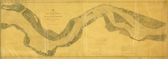
Chart of the Delaware River in front of the City of Philadelphia from Bridesburg to Fort Mifflin
Permanent ID:
12741Date:
1879Image Description:
Chart of the Delaware River in front of the city of Philadelphia from Bridesburg to Fort Mifflin, issued in December 1879 under the direction of Carlile P. Patterson, Superintendent of the United States Coast and Geodetic Survey and verified by J. E. Hilgard, Assistant in charge of Office. Map features include elevations, soundings, and tides.This oversize item is found in the Series 25: Maps and Surveys (1683-1961, undated) section of the Chew Family Papers collection.
Format:
MapCollection:
Chew Family papersRelated People or Organizations:
Patterson, C. P. (Carlile Pollock), 1816-1881 (surveyor)Hilgard, J. E. (Julius Erasmus), 1825-1891 (surveyor)