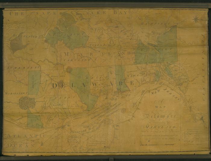
Map of the State of Delaware and Eastern Shore of Maryland, 1801
Permanent ID:
12900Date:
1801Image Description:
Map of the State of Delaware and Eastern Shore of Maryland, with the Soundings of the Bay of Delaware, 1801. Engraved by Francis Shallus in Philadelphia. The map features towns, villages, bridges, mills, taverns, plantations, places of worship, post and common roads, and hills.This oversize item is found in the Series 25: Maps and Surveys (1683-1961, undated) section of the Chew Family Papers collection.