Plan of Three Lots in Port Richmond, 1835
Permanent ID:
14013Call number:
Of 632 1835 TDate:
1835Image Description:
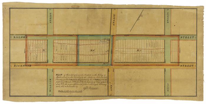
A map depicting three lots between Salmon and Richmond Street in Port Richmond.Inscription:
PLAN of three lots of ground, situated in the Village of Richmond, in the township of the Northern Liberties and County of Philadelphia, designated by the No. 5,687-No. 5, the property of Sarah McCall-No. 6, the property of Eliza Gibson, and No. 7 the property of Louisa Gibson: Surveyed, February 26th, 1835, & delineated by John Thomsonscale, eighty feet to the inch
Address:
Richmond District, Northern Liberties, PhiladelphiaFormat:
MapDimensions:
Width: 54.2 cm, Height: 26 cmLibrary of Congress Subjects:
Port Richmond (Philadelphia, Pa.) [info:lc/authorities/names/n2005079465]