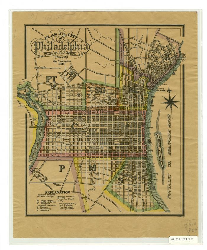
F. Drayton Plan of the City of Philadelphia, 1824
Permanent ID:
11312
Call number:
Of6101824DF
Date:
1824
Image Description:
Map of Philadelphia compiled from surveys in 1824. Map uses color borders to show boundaries between the city proper and its outlying townships: Penn Township, Spring Garden, Northern Liberties, Kensington, Passyunk, Moyamensing, and Southwark. Also shows various streams that ran through the city, and labels what is now known as the Schuylkill River as the "Manaiunk or Schuylkill River."
Format:
Map
Dimensions:
Width: 27.5 cm, Height: 33.5 cm (case)