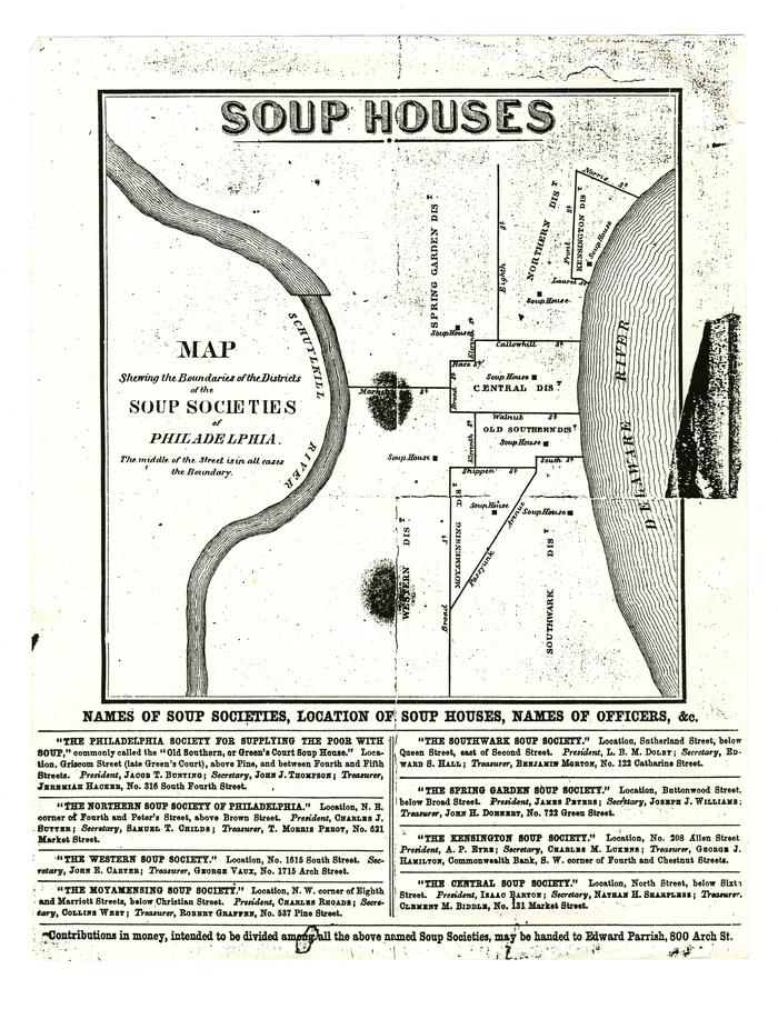
Map shewing the Boundaries of the Districts of the Soup Societies of Philadelphia photocopy, [1862-1880]
Permanent ID:
11688Date:
circa 1862 – 1880Image Description:
Photocopy of a map showing the locations of Philadelphia soup society houses and the boundaries of the districts that they serve. Includes the following districts: Kensington, Northern, Spring Garden, Central, Old Southern, Southwark, Moyamensing, Western.Format:
Map; BroadsideDimensions:
Width: 22 cm, Height: 28 cm (image)Collection:
Kensington Soup Society RecordsRelated People or Organizations:
Kensington Soup Society (Manufacturer)Edward Parrish, 1822-1872 (relates to)