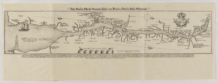
Nova Sueria: Eller the Swenska Revier (now Delaware River) in India Orridentalis [Map of New Sweden on the Delaware River]
Permanent ID:
11721
Date:
1654 – 1655
Image Description:
Map of Swedish settlements along the Delaware River, 1654, from Cape May all the way north to Fallet Asin pinck (falls located near present-day Trenton). Original drawn by Peter Lindstrom, Royal Swedish engineer.
Format:
Map
Dimensions:
Width: 53 cm, Height: 19.5 cm (image)