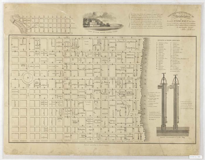
Map of Philadelphia for use of Firemen and Others, 1820
Permanent ID:
11891
Call number:
Of 610 ca. 1820
Date:
circa 1820
Image Description:
Map of Philadelphia showing the locations of fire plugs (fire hydrants), and listing the names and locations of fire houses. Also includes a diagram of the inner workings of a fire plug, and a short summary of the Fairmount Water Works, which supplied water to the fire plug system.
Address:
Philadelphia
Format:
Map
Dimensions:
Width: 62 cm, Height: 49 cm (image)