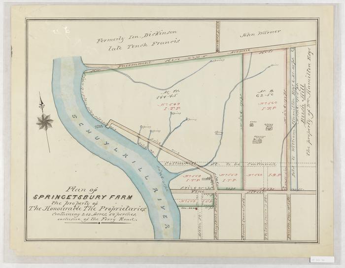
Plan of Springetsbury Farm
Permanent ID:
12408Call number:
Of 601 SpDate:
1784Image Description:
Map of Springetsbury Farm (also called Springettsbury Manor) drawn after 1854, but copied from John Hills' 1787 map of the same area. Shows the Schuylkill River with several springs; Schuylkill Front Street connecting to the Upper Ferry; and the properties of Jon Dickinson, Tench Francis, John Warner, Bush Hill, and others.Format:
MapDimensions:
Width: 57.5 cm, Height: 45.5 cm (image)Related People or Organizations:
Francis, Tench (relates to)John Hills (cartographer)
Dickinson, John, 1732 - 1808 (relates to)