General Forbes marching journal to the Ohio by John Potts maps, 1758-1759
Permanent ID:
12759Call number:
Of 506* 1758;Of 506* 1759Date:
1758 – 1759Image Description:
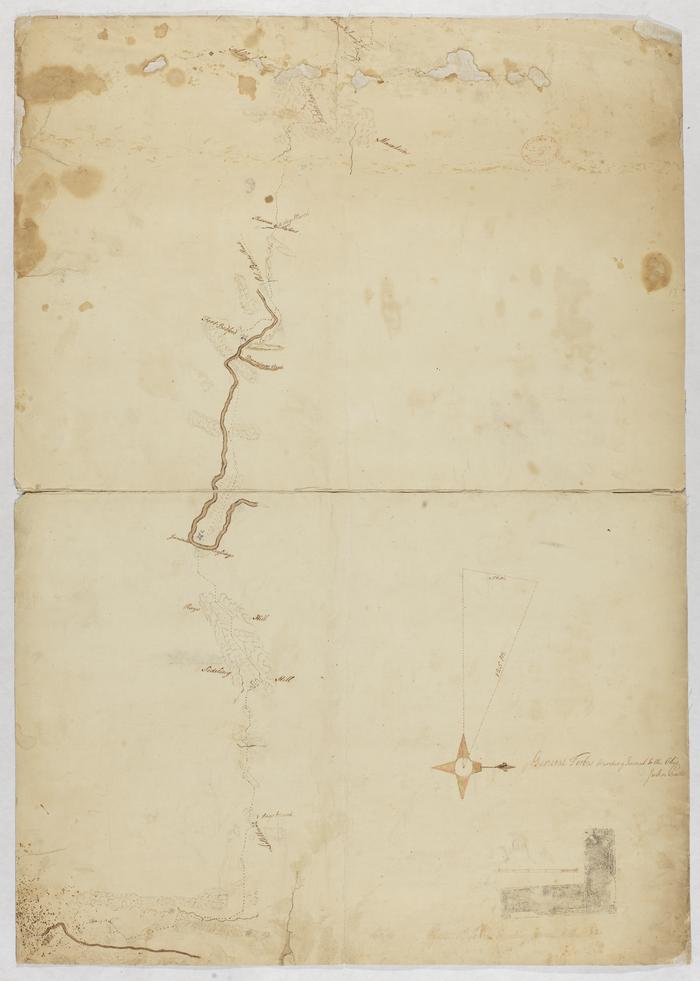
Two maps showing the route taken by British General John Forbes on Forbes Expedition during the French and Indian War. During the summer of 1758, Forbes and his company constructed a road, as seen on these maps, from Carlisle, Pennsylvania to Fort Duquesne at the at the confluence of the Allegheny and Monongahela Rivers (in present-day Pittsburgh, Pennsylvania). Their expedition's objective was to capture the French Fort Duquesne; however, once the British troops were within a 3-day march from the fort, the French forces burned it.These maps show the route taken by Forbes, crossing streams, hills, mountains, and passing several forts including Juniata Crossing, Fort Bedford, Sittelton, Fort Ligonier. The maps show places of encampment of General George Washington and Colonel Henry Bouquet. Map 2 labels the ruins of Fort Duquesne as "Pittsburgh," marking its passage from French to British hands.
Inscription:
Ms Route or Forbes Expeditiontaken from the
(Shippen Papers)
No. 1 (Verso 1)
Forbes Expedition
No. 2 (Verso 2)
Format:
MapDimensions:
Width: 52.5 cm, Height: 61 cm (image)Collection:
Shippen family papersRelated People or Organizations:
Potts, John (cartographer)Forbes, John (relates to)