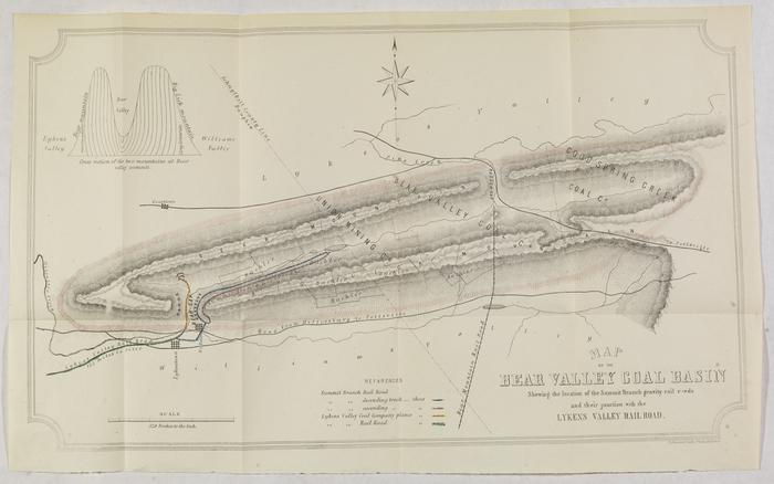
Map of the Bear Valley Coal Basin, showing their location of the Summit Branch gravity railroads and their junction with the Lykens Valley Railroad
Permanent ID:
12823
Call number:
Vp .864
Date:
1851
Image Description:
Map of the Bear Valley coal basin in relation to Lykens Valley, Williams Valley, and various railroad lines and creek beds. The map depicts the area around the border of Schuylkill County and Dauphin County.
Format:
Map
Dimensions:
Width: 44 cm, Height: 27 cm (image)