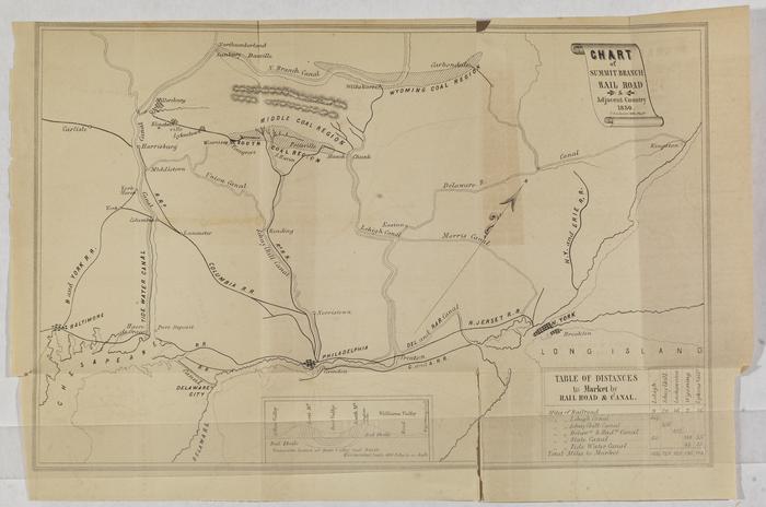
Chart of the Summit Branch Railroad and Adjacent Country, 1850
Permanent ID:
12824
Call number:
Vp .864
Date:
1850
Image Description:
Map of the Northeastern United States from Long Island to the Chesapeake Bay, showing the routes of the Summit Branch Railroad, which transported anthracite coal from Schuylkill and Dauphin Counties to Philadelphia and New York City. Small inset shows a cut-away of the red shale region of Bear Valley.
Format:
Map
Dimensions:
Width: 34 cm, Height: 23 cm (image)