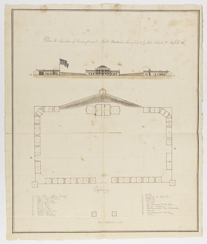
Plan and Elevation of Encampment Belle Fontaine, 1812
Permanent ID:
14525
Call number:
0466
Date:
1812
Image Description:
A map of Fort Bell Fontaine drawn by Charles Gratiot under the leadership of Daniel Bissell.
Address:
Fort Belle Fontaine
Format:
Map
Dimensions:
Width: 44.0 cm, Height: 52.5 cm