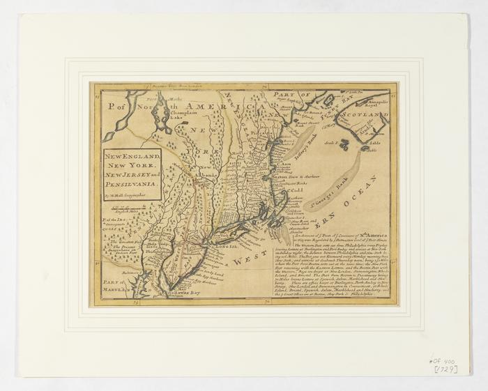
Map of New England, New York, New Jersey, and Pensilvania by Herman Moll, cartographer
Permanent ID:
8796Call number:
Of* 400 [1729]Date:
1792Image Description:
For original map description: "An Account of ye Post of ye Continent of North America as they were Regulated by ye Postmasters General of ye Post House."
Format:
MapDimensions:
Width: 41 cm, Height: 32 cm (frame)Width: 35 cm, Height: 23 cm (image)