User Options
Toggle navigation
Login
Register
Login
Register
About
Browse
Objects
Collections
People/Orgs
Advanced Search
Gallery
Contact
FAQ
Search Help
Hint:
Mouse over image for zoom and download controls
Comments and Tags (0)
Login/register to comment on this object
Share
Download as PDF
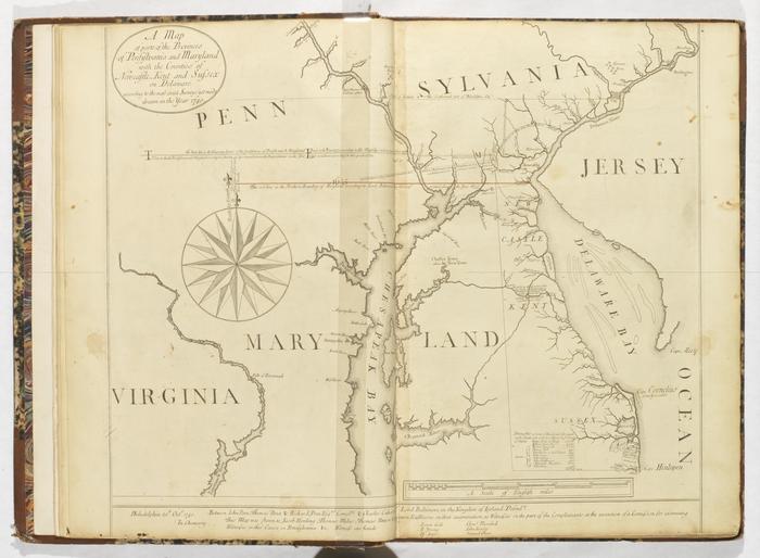
A Map of parts of the Provinces of Pensilvania [Pennsylvania] and Maryland with the Counties of Newcastle, Kent, and Sussex on Delaware according to the most exact Surveys yet made drawn in the year 1740
Permanent ID:
9041
Date:
October 20 1740
Address:
Philadelphia
Format:
Map
Collection:
Penn family papers
Related Person or Organization:
Baltimore, Charles Calvert, 1637-1715
(relates to)